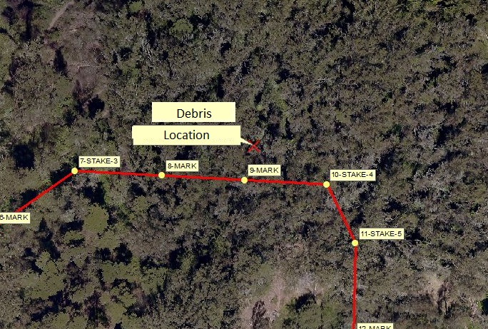
The Mount Sutro Open Space Reserve and San Francisco Rec and Park's Interior Greenbelt park, found in the heart of San Francisco, are a combined 75 acres of open space for the public to enjoy. With no markers or boundaries between the two open-spaces it is nearly impossible for a visitor to determine when they have passed from one to another. The property line became important when UCSF prepared to clean up the remnants of a makeshift shelter in the center of the open space. Staff from Planning, Police Department, and Community and Government Relations turned to GIS to determine the actual location of the debris.
The tree canopy and steep topography provided a challenge as consumer grade cell phone GPS accuracy was not sufficient, often providing locations 20-30 feet off. Instead, the GIS team used a high-precision GPS receiver to capture the latitude and longitude of the site, which was then plotted against the UCSF property line layer. The result clearly showed the debris location within the SF Rec and Park property by 20 feet. The map and coordinates were then provided to SFREC personnel to handle the cleanup.
The Enterprise GIS, with UCSF property lines, saved the university thousands of dollars in clean up and staff time by providing staff with timely and critical data.


